From Local park 2017 Dec 13


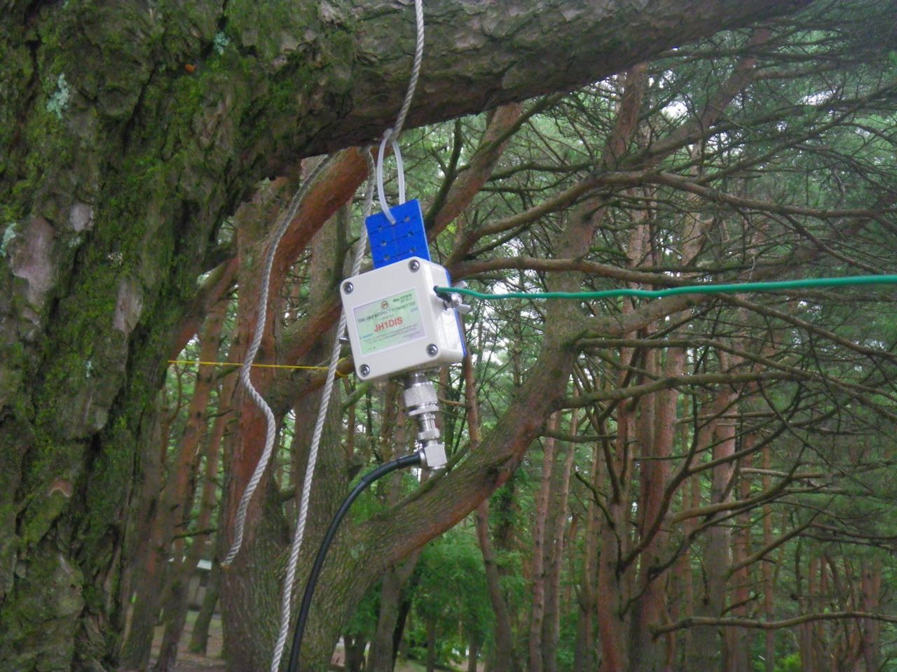
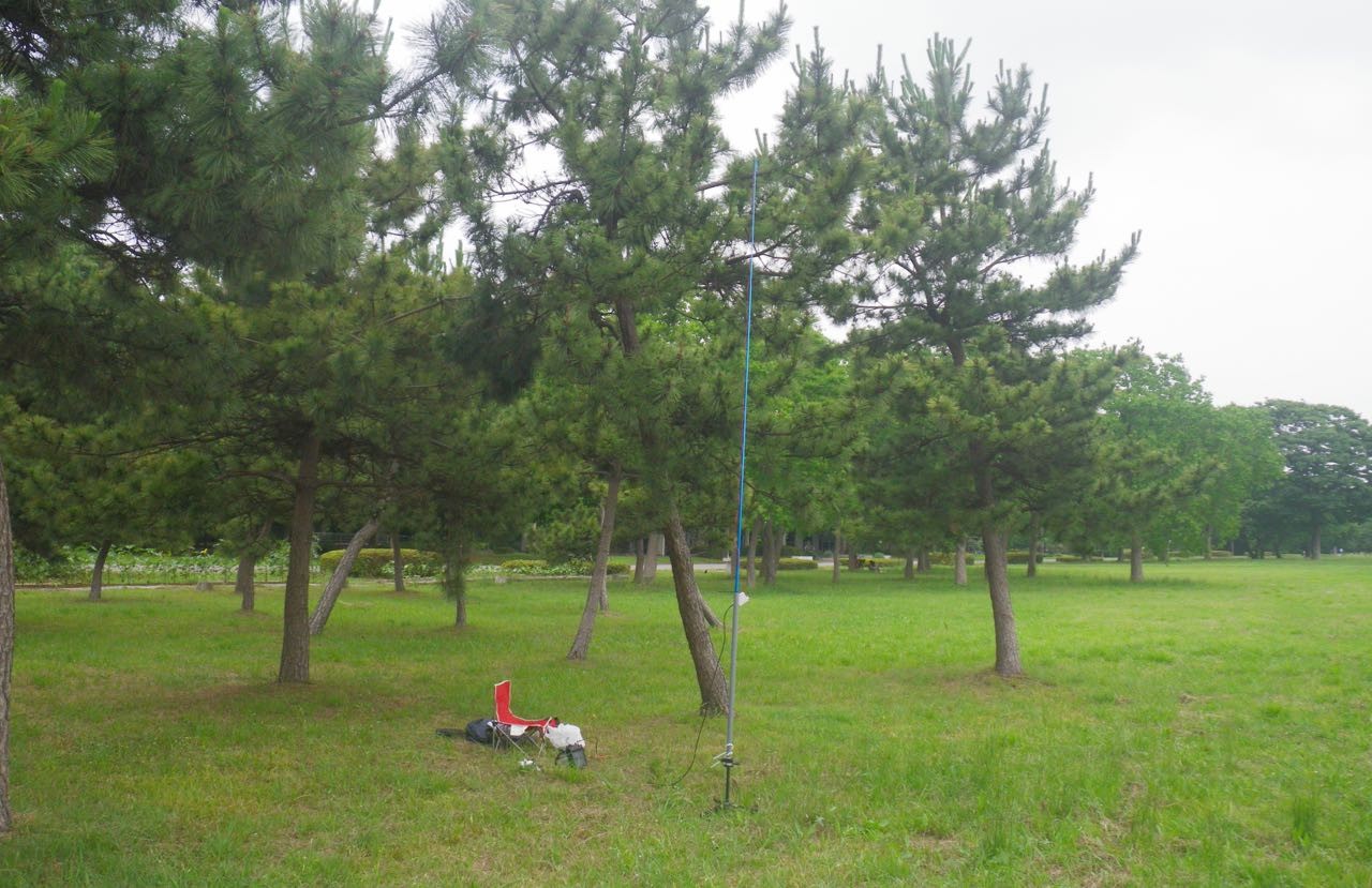
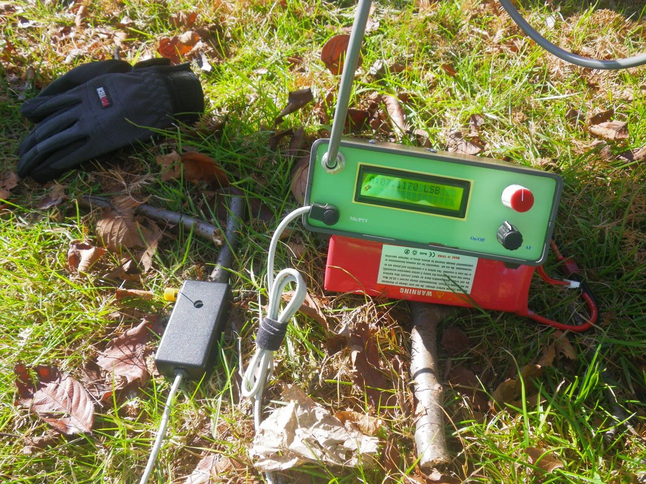
I went to Local park and NE 6.5Km from my home .Latitude: 35.794207  Longitude: 139.869003Locator: PM95WT40GO  (map, sat, terrain)QRV for 1 hour in the morning.It was the second challenge to QSO by Bitx 40 and EFHW. I had 2QSO .It was a short time QRV. The distance of NVIS QSO was about 200 km.The signal report is 57 with QSB. Bitx40 dose not have S meter,so His signal is strong so I reported 59.Yoshio / JH1DIS
  3324 просмотров
3324 просмотров

2017/11/29 Cape Futtsu AO-91 PM95VH73

I went to Cape Futtsu. Nov 29 2017
It is fine weather, temperature is 19 degrees, south wind 1 knot.
Cape Futtsu is located in the entrance of Tokyo Bay.

Читать дальше…
  3603 просмотров
3603 просмотров

2017/10/27 Daibosatu Pass & Ishimaru Pass PM95KR27

It was a 10 km trekking.Altitude from 1600 m to 2051 m.Kami-Nixtukawa Pass - >Thunder Rock ->Mt Oyafuchinokashira(1950m)->Daibosatu Pass -> Mt Kumasawa - Ishimaru Pass -> Kami-Nixtukawa Pass.it takes about 6 hours(include Break, lunch and QRV)

HF is impossible, so 430 MHz FM + 3 ele Yagi.Shortening setup time. I had 10 contact from 1950m.QRV at Mt Oyafuchinokashira.(Break andlunch)

Читать дальше…
  3725 просмотров
3725 просмотров

Mt Ikenodaira Altitude 2090m Oct 10 2017

I went to Ikenodaira Miharashidai Altitude 2090 (Nagano Prefecture. Tom city.)200 km northeast of Tokyo.
70 cm 10 ele, Kenwood TH-K 40
It was fine weather, walking around Ikenodaira. I saw the sea of clouds in the morning and it was a wonderful view.
Читать дальше…
  2883 просмотров
2883 просмотров

Hakkaisan


August 6th. QRV at 430 Mhz / 50 Mhz from Hakkaisan Shrine (1540 m) climbed for 1 hour from Happagahara Omoro-dai (Tochigi Prefecture). 430 Mhz is 10 elements, 50 Mhz is EFHW vertical. Arrived at Hakkaisan Shrine around 8:30 AM Antenna installation after break. 430 Mhz FM TH - K 40, 50 Mhz SSB FT - 817 It was fine until 10 o'clock but the gas came up and the weather quickly withdrew. It was 17 QSO. My wife carries food and water. Grid: PM96vv    Marker: 36° 54' 5'' N    139° 47' 55'' E   //  Lat 36.901347 ...
Читать дальше…
  2875 просмотров
2875 просмотров

Lake Motosu 07/28 2017


wen to Lake Motosu 07/28 2017  Grid PM95hl Lat 35.458704 // Lon 138.600683      Using 40 mEFHW and NVIS propagation. Result: During the daytime, 300 Km - 500 km was SSB 59.       Outdoor GPS time sync for JT65 
  2804 просмотров
2804 просмотров

I tried 6 m of Sporadic E.


Tried 6 m of Sporadic E. ant is EFHW /FT-817 The setting time of this antenna is 5 minutes. The weather is a bit cloudy, temperature is 28 degrees, south wind 2 knots. I ate lunch and  QSO. Worked 8QSO (JA4,JA5,JA6 500km~1000km)  Location: I went to Mizumoto Park 6.4 km northeast from my home. Marker: 35° 47' 41'' N  139° 52' 10'' E  Grid :PM95wt 
  2916 просмотров
2916 просмотров

2017 June 20 I went to Mt.Chausu.

2017 June 20 I went to Mt.Chausu.
Mt. Chausu is an active volcano. Altitude is 1,915m.
Grid : PM97xd
Marker : 37° 7' 32'' N 139° 57' 51'' E

Fair weather, north wind, wind speed 1 knot. The temperature is about 20.
70cm FM 1W and 6 QSO. 6m FM no contact .
It was a volcano, but an insect was a lot on the mountaintop and gave up setting an antenna. so handy whip only.

More pict :
http://psksdr.blogspot.jp/2017/06/2017-june-20-i-went-to-mtchausu.html

  2761 просмотров
2761 просмотров

2017/04/28 Mt Hangetu Altitude is 1750 m ,PM96rq

Mt Hangetu Altitude is 1750 m ,PM96rq Marker: 36° 42' 24'' N 139° 28' 30'' E I tried 40mSSB using Bitx40. but condition is not so good. So setup 70cm 3ele and TH-K40 1W. I had 4 contacts. The longest distance is 200 km to the Izu peninsula. de JH1DIS

Читать дальше…
  3111 просмотров
3111 просмотров

JH1DIS Local Park

I wen to local Mizumoto Park , 7km from my home QTH,
Location : Lat 35.794146 Lon 139.869175 PM95wt
This time test and check 5 band MLA (40m,17m,15m 12m and 10m)
WX fine and Cherry tree full bloom, North wind 8 knots, temperature 13 degrees. Slightly cold.
Starting time 14:00 (Local time) and only 40m .
Worked 2 QSO mode JT65 500km.
Well A problem happened. It was poor in the contact of antenna connector, So SWR became up/dowm.
https://goo.gl/photos/WXhgtCBKvF7fFYX26


JH1DIS yoshio

  2935 просмотров
2935 просмотров